
Bridges, Beaches and Butterflies.
I wasn't working Friday and the forecast said the sun would be out in the afternoon. So I cooked dinner (while the rain fell) then left in time to catch the 11.43 down the coast to sunshineville. It was still a bit overcast getting off at NB but things improved all afternoon as promised and I had a very splendid time.
I wasn't working Friday and the forecast said the sun would be out in the afternoon. So I cooked dinner (while the rain fell) then left in time to catch the 11.43 down the coast to sunshineville. It was still a bit overcast getting off at NB but things improved all afternoon as promised and I had a very splendid time.


I was swithering about doing NB Law to start with as there was quite some way to go, but I was glad I did. There is always something good to take photos of and I was pleasantly surprised by the gang of ponies which aren't always as cooperative about posing for photos.


Painted Lady

After the law I followed the JMW but took a right turn at the (ice bucket challenge) curling pond below Balgone House. The place was hoaching with life. Moorhens called out in appreciation of my company and a couple of swans with a small army of cygnets over the other side kept a watchful eye. I stood at the dilapidated jetty taking photos of the damselflies.

This is where I went in last year. The amount of slime and algae and weed in and on the water is not conducive to swimming and I resisted the temptation.

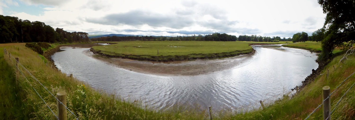
I like these reflections for looking more like a painting than a photo.

As I stood taking photos I could feel all manner of insects landing on me and making friends. Mostly I played hard to get, and did some dance steps, then I felt this one, recently emerged, climbing to higher ground. It hadn't even pumped up it's wings fully.


I spent far too long messing about here. The general plan was to do the usual NB circuit - down the JMW towards E Linton turning left at Stink Farm, then through Newbyth Woods, across the road into Binning Woods, then instead of heading on to the coast, go further south east back on the JMW and explore a wee project that I've had in mind for a while. Then back up the beach to NBerwick and head back on trails and beaches to Aberlady and then to Longniddry Train Station. I quick sketch on mapping software suggested this would be under 31 miles, so as long as I didn't dick about with too many diversions.... Also I had a plan for a war memorial nobody has claimed so far, towards the end of my route.


Traprain Law

murder on the telephone lines

Now this one was a new species to me. Speckled Wood. Flew alongside me (territorial?) for a bit then landed 12' up in a tree, which is exactly what they're supposed to do. Maybe it was flirting?


As you can see from the map (halfway down this page) I visited 2 of the 3 hubs in Binning Woods. This is at the centre of the largest hub and I claim it for my War Memorial. For fallen trees rather than soldiers, but you know how much I like to push boundaries and challenge authority. I hadn't thought of it until I arrived there but it turned out handy since I didn't actually get to my planned WM.

This is the last public bridge over the Tyne upstream of the estuary. Or is it? It is an important question as it makes travelling (on bike or foot) from Dunbar to Ravensheugh Sands and arduous affair involving 2 or 3 miles of dreary straight tarmac. If only there was another way? (Without rampaging through Tyninghame House Estate.) If you scrutinise the map there is a smaller bridge, about 1 km downstream. To access it from the Dunbar side you have a bit of a bushwack off the JMW then a traipse across a field of sheep, then voila, an antique iron and wood footbridge. Various reports said it was hard to access, locked and / or unusable. I had never taken the risk of a long retreat to ascertain the naked truth TILL TODAY. Plan B was to go back to the JMW and along to sand banks at the estuary and wade across. (Shoes off and small towel lurking in back pack.) Low tide was 4.20pm which was the deciding factor on route choice.

This is Point A on the map. JMW on the right along to Hedderwick, bushwack along raised bank at left heading towards those trees on the other side of the Tyne.

Bernie said "there is a slight scarper across the front lawns of the big house" but the trees give you a reasonable amount of cover.

So this is the bridge. I crossed it very tentatively and would advise no more than one at a time. The gate, at midpoint, is imposing and nothing short of keep-out-oiks. It was closed but not padlocked. It feels locked but if you hook a toe under the bottom and give it a firm open sesame, it concedes. There was a bunch of cattle on the north side watching my progress with interest. I kept an eye on them and was ready to vault the barbed wire fence (and swim the river) if necessary.

Dotted line is Limetree Walk. This bridge means you can cut across from point A on the JMW missing the long straight tarmac bits. The downside is it's not much shorter and there is some difficult ground. But it is MUCH prettier. I didn't inspect the wade options (large white arrows) but suspect it might end up bad in knee deep squelch or rocky and barnacle hop scotch. A treat for next time.

You can see the sweet rise of the original has flopped with age, but hopefully being Victorian it was massively over-engineered and could take a train. I understood the unpadlocked nature of the span to be an invitation to use it to access the field edge which joins up to the coastal paths off the end of Limetree Walk. I had originally planned to check out the bridge then return to trial the estuary mouth wade but its quite a hike over tussocky ground along the raised bank, and I didn't want to disturb a second time the field of sheep and lambs.
No easy wades across here.

A fence to climb then good trails resume. I had eaten lunch while walking the rough overgrown path at the square end of the estuary. (2 slices of bread with honey, lemon curd and cheese. Sort of like cheese cake.) I was only about a dozen miles into the run but breakfast felt a long time ago. I also had a couple of things out the ultrabox: double decker and Gu gel. Nothing more till NB.


Mr Crabby

I was considering exploring this wooded peninsula; maybe next time, I was trying to keep moving onwards to NB remembering I had 13 miles beyond that to run.

delightful trails

I particularly like this bit of coast where you come round the headland on really great paths and the vista of Ravensheugh Sands opens out in front, all the way to the Bass Rock.


Low tide and sunshine confirmed the ideal route choice and I was so stoked to be pretty much the only person there (apart from a couple of families at the Tyninghame end) that I opted to go in for a dip. (I had the small red towel from the Solstice Tri.) I piled everything on the wet beach and ran into the surf in what I hoped wouldn't be a Reggie Perrin moment. My legs were all nettle and pollen rash from the overgrown paths and the water was totally refreshing and took the sting out. It didn't feel too cold - and just as well. I walked out to waist deep and the next big wave went over my head. I couldn't take the non-waterproof camera in so left it running in video mode. I'll maybe edit and post the results.

When I saw the sun sparkling off the surf I knew I had to go in.


Quite a lot of messing about. The little towel was soaked and sand-saturated by the time I had done a couple of takes of the video, in and out the surf. I brushed the sand off my feet before pulling on wet socks. I had taken a spare pair of shorts (in case the estuary-wade was deep) and felt really freshened up by the cool water. It was now the hottest part of the day and I could feel the sun beating down on my head.

Sorry to meet this young one - the net cutting into the back of his neck presumably the cause of death.

My usual ploy is to leave the coast at the Peffer Burn. However the low tide made it easy to cross the burn and I stuck to the beach round to Seacliff. There is a bit of rockhopping which is quite hard work and slows the pace right down. But Seacliff is always worth a visit.


Seacliff beach.
This was about as close as I got to the tiny harbour at the far (left) end although I did notice there were bikers there and I suspected I would know them. (The long lens makes them seem much closer but I felt I couldn't really take the time to go over and chat as I was already WAY behind schedule. Also I couldn't really make out who they were on the back of the camera as the bright sun was killing the screen. If I'd known it was Jason..)

Jason and Mark.
I followed their tyre tracks back to Gullane.

Got offered a lift.

I had run out of fluids a long time before I got back to N Berwick. As ever I spent the last 2 miles along that road thinking about how cold the drinks would be when I got to the Tesco's. I couldn't think of a cold drink I didn't want. After a run up and down the drinks aisles I bought water (big) and 7up (small) for the backpack and a yoghurt milkshake which never made it out the carpark. I also bought a sandwich but after filling up with fluids there was no room for solids. I saved it for the train.

Somehow it was nearly 22miles by the time I crossed NB. In the past I have done 17 and 19 on that circuit, so the extra fannying about at the bridge had added some, but it was still much longer than anticipated. Trouble was I couldn't take some off the Longniddry end unless I was to run a bit along the coast and then back to Drem. The miles from the coast to Drem are on awful roads that have no runnable pavements, just grassy verges to dive onto as the cars rush round blind corners. So Longniddry it would have to be. I hoped the nutrition would bring relief to my aching bones. Actually I wasn't in bad shape. Nothing felt injured, I was just getting a bit tired and there was little in the next 13 miles I was excited about. It was a lovely evening but I would prefer to sit down and watch it with a beer in my hand. I had to divert down towards the shore rather than along past the station at NB because I couldn't trust myself not to jump on a train if there was one there. I only needed to get to 28 miles as the other couple to, and from, Waverley would top the required 30.

salty shirt


The number oif times I could be bothered to get the camera out decreased. It was a superb evening, but I was still trying to work out how I could flag down the train before Longniddry. There just didn't seem an easy answer. Instead of thinking about the distance still to run I tried to get distracted by the surroundings. Slowly but surely Fidra came and went, Yellow Craigs, Archerfields and then rounding the trails (still following the 2 sets of fat tyres) I could eventually see Gullane. I plodded on taking the route of least resistance. There was a dude running with his dog at this end of Gullane and my competitive side took note of what pace he was setting. OK if I hadn't just run a marathon I could keep up. Gullane beach was curiously empty. I thought the Open would have spilled it's extras onto the beach as it it was such a pretty evening. By the time I got most of the way to the end of the beach the runner with his dog was returning and I was picturing the necessary route beyond Gullane Point along Aberlady Beach, over the bridge and up the road to Longniddry.... and the runner and dog turned into Neil and Harry. Never one to miss the chance for a quick moan I explained my woes to Dr Neil who said he was on his way to the car park and could drop me off at the station of my choice. I checked the Garmin (it would be 28+ by the car park) and you know when you are faced with a get-out-of-jail-free-card at the end of a long day and you suspect you have to turn it down because it wouldn't be the proper thing to do, it would be too easy, the wrong way to finish a special day? Well fuck that, car's in the car park? Let's go! A convertible Jag you say? am I dreaming? Did I die and fall face down in the sand? Drem will do nicely and I'm already looking forward to the sandwich on the train. Yeeeehah!


Harry, Neil'sson, sorry that is a tragic joke.
He had to sit in the back cause I stole his seat in the front.
He had to sit in the back cause I stole his seat in the front.

Last night a GP saved my life

No comments:
Post a Comment