
I caught the earliest possible bus to Lauder. (£5.20) It arrived at 10.20 a couple of minutes late and it took me a bit of time to get settled into the run: adjusting kit (putting a glove in my specs case to stop them rattling), finding the start of the route and generally messing about.

I only really became aware of the potential for long distance runs on the Southern Upland Way when Kenny V suggested the SoL runners do an ultra distance run from Cockburnspath to Lauder (around 30miles). I thought I would do a recce on the first decent day and decided to do it the other way round. Mostly because I am more familiar with the area near the coast and should the dark be closing in at the end of the day I would be near the John Muir Way and Dunbar and less likely to end up using terms like "ordeal."

loving the foxy weathervane

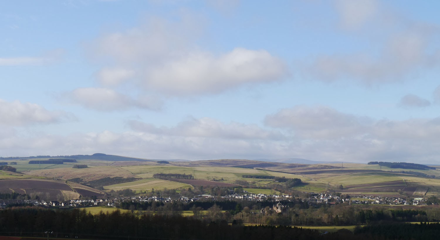
Thirlestane Castle behind Lauder.


The great things about a "way" is that there are loads of markers to point you in the right direction and there should be less in the way of "gerroff my land" incidents. I printed out 5 A4 pages of maps and 3 A4 pages of route description and carried a compass which I thought was overkill but in fact was the absolute minimum. I had a small pack crammed full of waterproof, change of kit, sandwiches, more gloves and hats, chocolate bars and half a litre of drink. This tiny amount of drink was on the basis of buying more at Longformacus, 15 miles into the day. (At the end of map sheet 2) I reckoned I'd be there in a little over 2 hrs. I also carried notes on the bus time from Cockburnspath, and if I chose not to get that and ran onto Dunbar (a further 9 miles) train times from Dunbar to Edinburgh. As they say, the best laid plans....


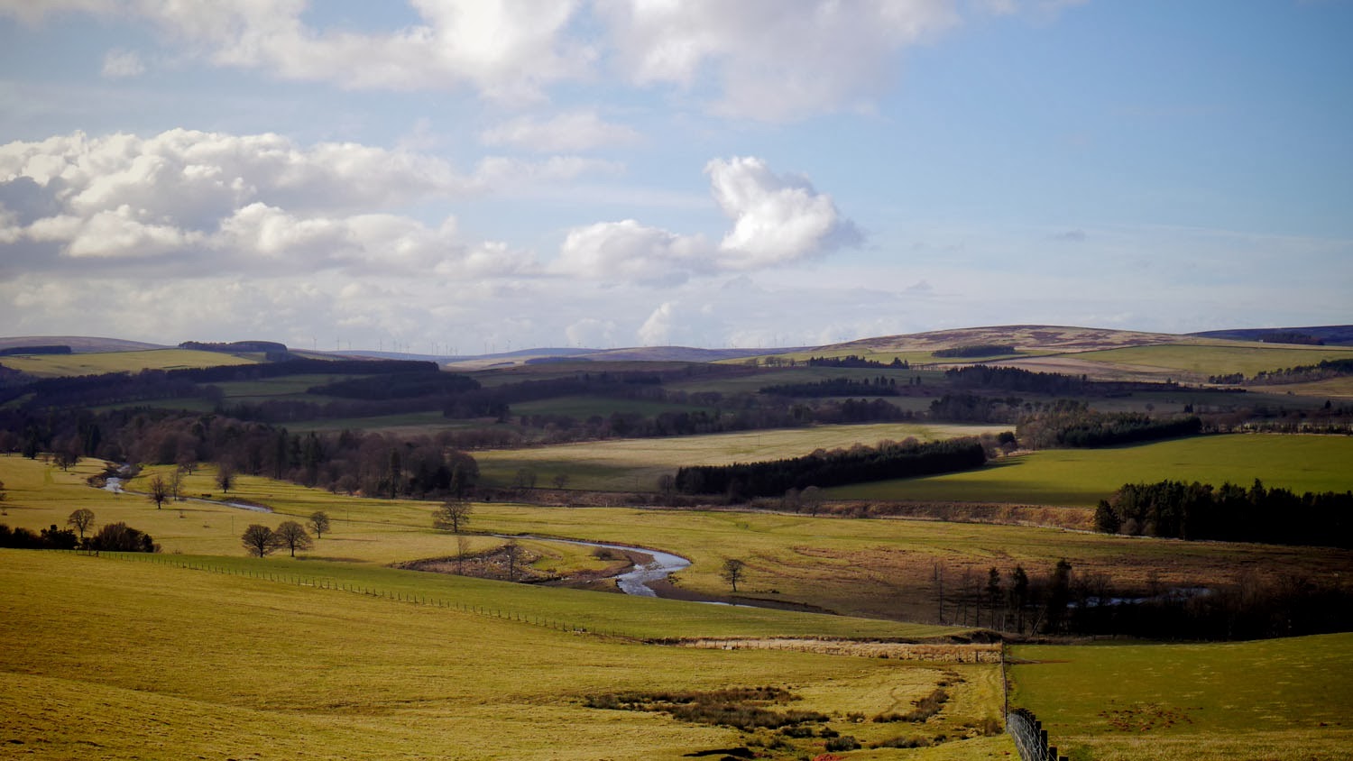
The route starts by climbing up from Lauder and into the Lammermuirs. This gives excellent views back down to Lauder (above) and a view of my sister's place on the hill above Lauder (below).


There is a temptation when heading out on a long endeavour to put in a few quick miles and get cracking on. Although there are plenty way markers some are separated by a long enough distance to go well off track. In the first few miles I took a wrong turn (and this is in perfect weather!) and after taking a bearing with a compass and finding a lack of a stream where there should have been one, got back on route. In the photo above I am about to head for the woods left of the top of the marker, but via the fields on the left of the photo.


Still heading for the woods but first, to the bridge to cross the stream. Now left of this bridge is a very ugly sign boasting about who (was it Queen Margaret's College?) built this bridge. Now while I am happy they did and it works with a 100% success rate (quite dry feet at this point) it is not something I K Brunel would swoon about.


Out the back of the woods and down this trail.

The ground rises to a high moorland plateau. It was almost impossible to keep feet dry here. Every immersion made me curse, the near frozen water takes a few minutes to get up to blood temperature. It was also very muddy in places so trail shoes are recommended.

Thin layer of ice just melting.


For quite some time you are aware of these 2 bumps on the top of the hill. Google Twin Law Cairns if you want to know more.
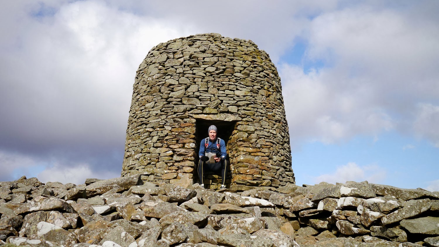
Since the sun came out I stopped long enough to take a selfie and video the panorama, which was pretty spectacular. In my hand are the map pages in a waterproof map carrier. I carried that the whole way (rolled up) in my left hand, and my camera on tripod in the right.


Not THAT Peter Jackson then.


In the second cairn a bottle of Sloe Gin with a couple of inches of dubiously dark content and a box of celebrations. Now I assumed the latter would contain a geocache thingy but to my surprise it contained Celebrations! Also a wee pencil and notebook in which to write your thoughts. I had plenty of food and drink with me so didn't partake. I also had evil thoughts as I ran down the hill about maybe leaving chocolates laced with laxatives. Just for fun!

Twin Law Cairns marked the end of map sheet 1.


I was now so full of the joys that I shouted to these sheep that we'd do a group shot and could everyone just stand over there facing in this direction please.

The result.


This is a new windfarm road but you're only on it briefly.


Back to much nicer rural idylls.


Watch Water Reservoir just before Longformacus, the overlap between sheet 2 and 3.

Love the mole hills in a line.


Longformacus. Took well over 3 hrs: 50%+ the estimate.
I had a bit of a scout about but couldn't find a shop or post office. I still had most of my drink so wasn't too worried. Decided to have some lunch when I could find a nice spot.

There were peacocks in the grounds of Longformacus House, their plumage looking dazzling in the sunlight. I snuck round the back of some trees to get a decent photo but when it saw me the peacock took off running like a flipping velociraptor.

I had sandwiches on this recliner tree.


man down - now which way d'you suppose it used to point?


I spooked a hare that was about 3 yards from me here. Too fast to snap.
Beautiful and remote spot if a bit soggy.

Now this red path looks good. It's not: deep claggy mud.


the route goes up where?

this sign may have been photoshopped


This was reminding me very much of the trails around Traquair and Innerleithen.

soft going made for hard going

the dirtiest sheep ever - I had to tell them off for particularly bad housekeeping

There was no way past without wading through deep wet mud.


Halfway across map 3 Abbey St Bathans (20 miles in?) is a very off-the-beaten-track kind of place. I was hoping for a shop but there didn't seem to be one. I met this guy who lives there. I asked if I could fill my bottle and he graciously did so. There are a few rambling houses that look a bit 1950's and also a bit like Deliverance. There is the Riverside Restaurant ("as little or as much as you want") but due to lack of through traffic have sporadic hours and it's almost more of a hobby for the husband and wife owners. They suggested if we visit for the SoL run we phone in advance for soup etc. as they cook from scratch. I managed to buy a can of Coke (no Red Bull!).


Riverside Restaurant behind here.


Going across this chap's field I said hello. He came over for a chat and as he got close I realised in fact he was HUGE and could stomp me into the ground if he had a notion to. When I took the photo below the camera noise made him jump and I was lucky he jumped the other way or I'd still be in that field.


Now that is how to do a group portrait!


More mud.


I think as I read the notes for this part that there was a dogleg around the farm here. I failed to spot it and walked up the main road through the middle of the farm buildings. Luckily the 2 bear sized alsatians were in cages but they told me all about what they'd do if they weren't. I spotted the finish of the dogleg on the other side of hell and you can be sure I will remember it for the SoL run. Yes Sirree.

Going up here I passed the 26.2 miles.

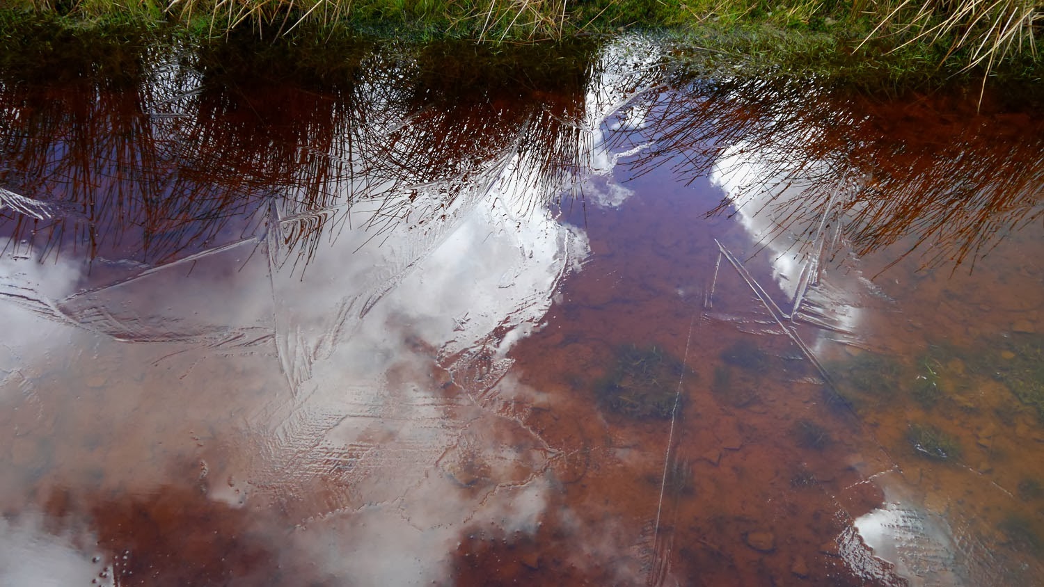
None of the rain that fell, fell on me.


Sundown and map page 4.


beginning to lose the plot (and the light.)

The first view of the coast, hurray!


This was a curiously drab nature reserve.

The last few miles are a coastal cliff ramble. In the dark. What could possibly go wrong?

Pease Bay Caravan Park. Quite nice except for the caravan park.

I'm walking in the air.

Torness and the cement works. Strangely my familiarity with them and the anticipation of nearly there made them far more attractive prospects than the horrible battery farmed caravans of Pease Bay.

Not sure what this was but I wasn't hanging around to find out.
Now things were going downhill. Not literally. I had wanted to use all available light and not get out my headtorch until absolutely necessary. Unfortunately I didn't get it out while I could still see and there were no lights about when it got dark. I had been jogging round the clifftop paths although they were really quite muddy and slippy. Luckily you couldn't see the vertical drops. However I was fading fast. I took this path up from the coast but felt there was no point in going into Cockburnspath. The last bus was 4.44pm. It was about 6.30pm. I had known for most of the day I was unlikely to make the 4.44 bus and therefore committed to another 10 miles to Dunbar for the last train. I was okay in that I didn't have any pain too great to continue, but needed some fuel. I ate several sandwiches which improved things no end. I drank the last of the Bathans water. I put on my headtorch and the cheery light was dazzling and reassuring. (I put the rechargables back in after Wednesday.) My brother phoned about then and I had a quick chat. Then Mary phoned to see if I was dead. I was anxious to get on but also dreading the next bit as it looked like there was no alternative to kerb crawling the lumpy grassy verge of the A1 in the dark. I'm afraid I might have been a bit short with Mary, and she had phoned to offer to drive out and rescue me. I just wanted to get it done.
Then as the hands on the clock of life slowly turned I saw the lights of a car pick out a pavement, a cycle path pavement on the other side of the road. The road itself was unlit so the pavement had remained unseen till now. I crossed the lanes with the care of a drunk threading a needle and double checked, triple checked the pavement was a designated cyclepath and not the narrower lane of a dual carriageway, or sliproad. I was in luck. Easy Street!

Hello British Nuclear Fuels lovely to see you there.
Easy Street ran out about Torness. However the bike traffic were directed to take a turn off and I met Route 76 a cycle friendly path from the back-of-beyond to god-knows-where. I was feeling my luck was in now and it would be plain sailing right onto Platform One of Dunbar Railway Station. And if the train was not on the platform, even better, a pint of Belhaven Best, Dunbar's finest would be consumed at the nearest jumping hot spot. I wouldn't even complain if the jukebox was on.

Hello cement factory, looking very Blade Runner.
There was a crossing beside the cement works that crossed the route of the heavy plant traffic. I looked both ways (sarcastically) then ran across 3 inch deep gloop, a kind of mud and cement soup that clung to my shoes like em...wet cement. I spent the next 2 miles doing to hokey cokey to try and kick it off.

There's always someone spoiling the party.


The rain held off till halfway home. Very pleased!
I got my mp3 player out for the first time since the morning's bus ride and the trip flew by. I ran somewhat crookedly down the road home, pleased with the way the day had gone. I had been fairly optimistic everything would go okay but you try to anticipate worse case scenarios and do what you can to avoid them. It is probably not a good idea to do these things solo as there is not always a phone signal to call for help when you are eaten alive or fall off a bit of high ground etc.
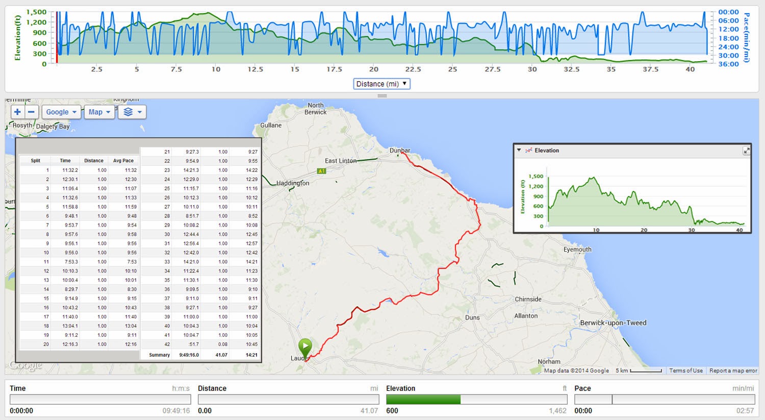
So in summary, £10 for travel, £1 for a can of Coke (I gave £1.50) half a loaf of homemade bread, some juice. And in return, 10 hours of adventure that covered most of the palette of human experience, from laugh out loud fun and games to serious concern I might be eaten alive by huge werewolfy dogs. I took 408 photos. I ran about 41+ miles from Lauder to Dunbar (30ish to Cockburnspath) and about 1.5 up and down the road at this end. The Garmin subtracts bits from distance when in auto pause mode, and I stopped every 15~45 minutes to check the map. I estimate the day's total around 44 but who's counting? The Garmin lasted all 10 hrs without running out of charge. Myself, a close second. A great day out over some very good ground, as well as a lot of harder miles over pretty rubbish ground. But the good stuff outweighed the bad and I look forward to the SoL run. Hope everyone's training is going well - with the ground waterlogged it will be a long day out. And the hills will be at the wrong end! But they are also the most inspiring part, but important to do in daylight. See you then!
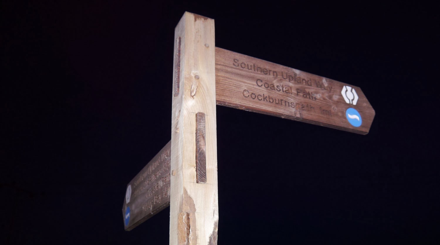
SUW website and route description
- although the description is in the direction I ran which will not work for the opposite direction so well.
I like the picture where none of the rain that fell fell on you best.
ReplyDeleteJust wondered have people run the SoL yet? and do you know how long did it take them?
ReplyDeleteSoL?
ReplyDelete